The border between Iran and Iraq stretches approximately 906 miles across some of the most rugged, mountainous, and inhospitable terrain in the Middle East, making it one of the longest and most difficult international boundaries in the region to monitor or control. Despite decades of conflict, diplomatic tension, and military buildup on both sides, neither country has ever managed to fully seal this border — and no outside power has either. During the eight-year Iran-Iraq War from 1980 to 1988, which killed an estimated one million people, both nations threw their entire military apparatus at this frontier and still could not prevent cross-border movement of fighters, refugees, and contraband.
This reality matters for American foreign policy discussions because claims about sealing borders — whether in the Middle East or elsewhere — often collide with basic geographic and logistical facts. The Iran-Iraq border runs through the Zagros Mountains, crosses vast marshlands in the south, and passes through Kurdish territories where tribal and ethnic loyalties have never aligned neatly with lines drawn on maps. This article examines the geography that makes this border so porous, the history of failed attempts to control it, the role of non-state actors who operate across it, and what this case study tells us about the broader limitations of border enforcement as a policy tool.
Table of Contents
- Why Is the Iran-Iraq Border Over 900 Miles Long and So Difficult to Seal?
- What History Reveals About Attempts to Control This Border
- The Role of Kurdish Populations and Non-State Actors Along the Border
- How Iran and Iraq Currently Manage Their Shared Border
- What the Iran-Iraq Border Tells Us About the Limits of Border Enforcement
- The Impact of U.S. Sanctions on Iran-Iraq Border Dynamics
- The Future of Iran-Iraq Border Relations
- Conclusion
- Frequently Asked Questions
Why Is the Iran-Iraq Border Over 900 Miles Long and So Difficult to Seal?
The Iran-Iraq border runs roughly 906 miles from the tripoint with Turkey in the north to the tripoint with Kuwait in the south. The northern portion cuts through the Zagros mountain range, where peaks exceed 11,000 feet and narrow valleys create thousands of natural crossing points that no fence, wall, or surveillance system can practically cover. Kurdish populations on both sides of this border have used mountain passes for trade, migration, and smuggling for centuries, long before either modern nation-state existed. The terrain is so extreme that even satellite monitoring struggles to distinguish between legitimate shepherds moving livestock and organized smuggling operations. The southern section presents entirely different but equally daunting challenges. The Shatt al-Arab waterway, where the Tigris and Euphrates rivers merge before emptying into the Persian Gulf, has been disputed territory for generations.
The surrounding marshlands — the famous Mesopotamian Marshes — cover thousands of square miles of reed beds, shallow lakes, and shifting waterways. Saddam Hussein drained much of these marshes in the 1990s partly to eliminate hiding places for dissidents and smugglers, an environmental catastrophe that still failed to establish effective border control. The marshes have since been partially restored, and the area remains functionally uncontrollable. Between the mountains and the marshes lies arid desert and plains, which might seem easier to patrol but present their own problems. The sheer distance involved means that any conventional border security force would need to maintain continuous presence across hundreds of miles of empty terrain with limited roads, no nearby population centers for support, and extreme temperatures that regularly exceed 120 degrees Fahrenheit in summer. For comparison, the entire U.S.-Mexico border is roughly 1,954 miles, and despite billions of dollars in annual spending, it remains far from sealed. The Iran-Iraq border faces similar scale challenges with a fraction of the resources available.

What History Reveals About Attempts to Control This Border
Every major power that has tried to assert control over the Iran-iraq frontier has eventually conceded that full enforcement is impossible. The Ottoman and Persian empires fought repeated wars over this boundary from the 16th through the 19th century, and the Treaty of Zuhab in 1639 — one of the oldest still-referenced border agreements in the world — established a line that neither side could consistently enforce. The British, who controlled Iraq as a League of Nations mandate after World War I, invested heavily in border posts and aerial surveillance but acknowledged in internal documents that smuggling and unauthorized crossings were constant and largely unstoppable. The Iran-Iraq War provides the most dramatic illustration. From 1980 to 1988, both countries deployed hundreds of thousands of troops along this border, laid millions of landmines, built extensive trench networks, and used chemical weapons. Even under these extreme wartime conditions, Kurdish peshmerga fighters moved freely across the northern border, Iranian Revolutionary Guard units infiltrated Iraqi territory through the marshes, and civilian refugees crossed in both directions.
The war ended in a stalemate with the border essentially unchanged, and within years, cross-border movement resumed at pre-war levels. However, if one assumes that wartime militarization represents the maximum possible border enforcement effort, then the Iran-Iraq War proves that even maximum effort falls short. The millions of unexploded landmines remaining from that conflict still kill and maim civilians today, a grim reminder that the most aggressive border control measures often harm ordinary people without achieving their stated security objectives. After the 2003 U.S. invasion of Iraq, American military commanders repeatedly identified the Iran-Iraq border as a primary route for Iranian weapons, advisors, and funding reaching Iraqi militias. The U.S. military, with the most advanced surveillance technology on earth, was unable to stop this flow. General David Petraeus acknowledged that Iranian-supplied explosively formed penetrators — sophisticated roadside bombs responsible for hundreds of American casualties — entered Iraq across this border despite intensive interdiction efforts.
The Role of Kurdish Populations and Non-State Actors Along the Border
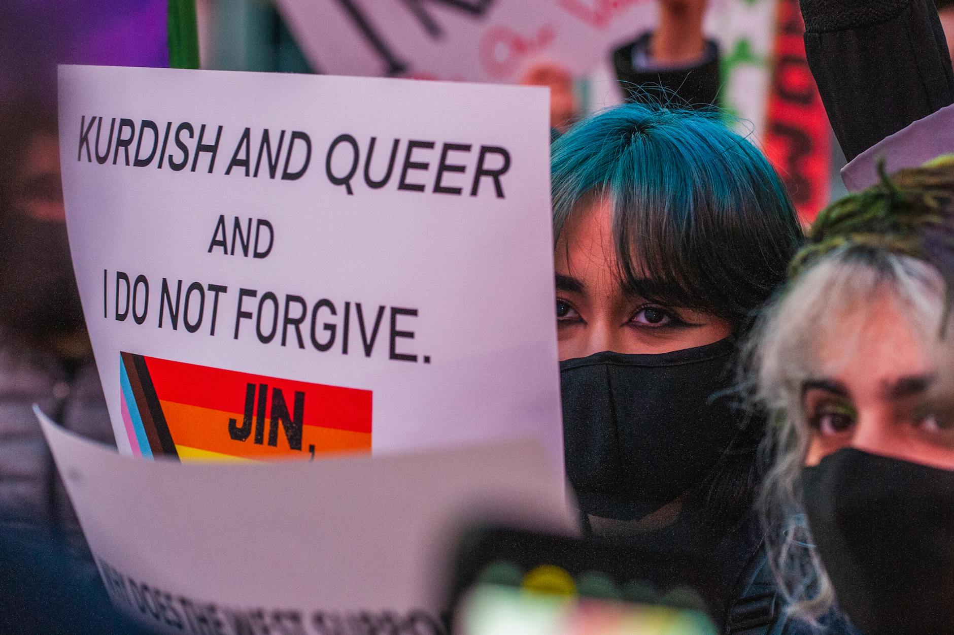
The Kurdish people, numbering an estimated 30 to 40 million across Turkey, Iraq, iran, and Syria, are the largest ethnic group in the world without their own nation-state. The Iran-Iraq border bisects Kurdish territory in the north, and Kurdish communities on both sides maintain family, trade, and political connections that predate and transcend the international boundary. The Kurdistan Region of Iraq, which has operated with significant autonomy since 1991 and formal constitutional recognition since 2005, shares roughly 200 miles of border with Iran’s Kurdish provinces. Cross-border Kurdish activity ranges from ordinary family visits and legitimate commerce to organized political and military operations. The Kurdistan Workers’ Party, known by its Kurdish initials PKK, has maintained bases in the Qandil Mountains along the Iraq-Iran-Turkey tripoint for decades. The Party of Free Life of Kurdistan, or PJAK, conducts armed operations against the Iranian government from Iraqi Kurdish territory. Iran periodically shells these border areas with artillery and has launched multiple military incursions into Iraqi Kurdistan targeting these groups.
In September 2022, Iran launched ballistic missiles and drone strikes against Kurdish opposition groups based in Erbil and Sulaymaniyah, killing and wounding civilians alongside militants, an escalation that drew international condemnation but did nothing to resolve the underlying cross-border dynamic. Smuggling networks operated by Kurdish traders move everything from fuel and consumer electronics to narcotics and weapons across the mountain passes. For many border communities, smuggling is not criminal enterprise but economic survival. Iranian fuel subsidies create a price differential that makes gasoline smuggling into Iraq enormously profitable. Kurdish kolbars — border porters who carry heavy loads of goods on their backs through mountain passes — are regularly shot by Iranian border guards. Human rights organizations have documented hundreds of kolbar deaths over the past decade. These killings generate outrage but have not reduced smuggling, because poverty and lack of economic alternatives in border communities are more powerful motivators than the risk of being shot.
How Iran and Iraq Currently Manage Their Shared Border
Both countries have adopted pragmatic approaches that prioritize managing cross-border threats rather than pursuing the impossible goal of sealing the frontier. Iran maintains a substantial border guard force, the NAJA Border Guard Command, supplemented by Islamic Revolutionary Guard Corps units in sensitive areas. Iraq relies on a combination of federal border enforcement, Kurdish peshmerga forces in the Kurdistan Region, and Popular Mobilization Forces — predominantly Shia militias, many of which have close ties to Iran — in other areas. This last arrangement creates the paradox of Iran-aligned forces being responsible for guarding Iraq’s border against unauthorized Iranian influence. The two countries operate approximately 15 official border crossings, with the Mehran, Khosravi, and Bashmakh crossings handling most commercial and civilian traffic.
Trade between Iran and Iraq exceeds $10 billion annually, making Iraq one of Iran’s most important economic partners and creating powerful incentives on both sides to keep the border functional rather than sealed. Iran exports natural gas and electricity to Iraq, and any serious disruption of border commerce would cause immediate economic pain in both countries. The tradeoff is explicit: both governments accept significant unauthorized cross-border activity as the price of maintaining the legitimate economic relationship. Iran tolerates certain levels of Kurdish militant activity on the Iraqi side as long as it does not escalate beyond manageable levels. Iraq tolerates Iranian militia influence because many of these groups fought against ISIS and remain integrated into Iraq’s formal security structure. Compared to a hypothetical sealed border — which would require a military commitment neither country can afford and would devastate bilateral trade — the current arrangement, while messy and sometimes violent, represents a rational accommodation to geographic and political reality.
What the Iran-Iraq Border Tells Us About the Limits of Border Enforcement
The Iran-Iraq case is instructive for broader debates about border security because it demonstrates several principles that apply universally. First, geography imposes hard constraints that technology and manpower can only partially overcome. Mountains, marshes, deserts, and waterways create natural crossing points that no wall can block and no surveillance system can continuously monitor. Second, when economic incentives for crossing exist — whether price differentials for goods, wage differentials for labor, or simple family connections — people will find ways across regardless of enforcement intensity. Third, the most aggressive border enforcement measures tend to produce humanitarian costs that are disproportionate to security gains. It is worth noting a significant limitation in drawing direct comparisons between the Iran-Iraq border and other international boundaries, including the U.S.-Mexico border.
Context matters enormously. The Iran-Iraq border exists in an active conflict zone with multiple armed non-state actors, sectarian tensions, and the legacy of a devastating war. Border challenges in other regions involve different geographies, different economic dynamics, and different political constraints. What transfers from case to case is the general principle, not the specific details: borders of this length, through difficult terrain, with strong economic or social incentives for crossing, cannot be fully sealed by any government regardless of resources or political will. Politicians who promise sealed borders — in any country, regarding any border — are making claims that no military or government in recorded history has achieved under comparable conditions. The Iran-Iraq border, with all its history of war, militarization, and surveillance, remains one of the clearest demonstrations of this reality.
The Impact of U.S. Sanctions on Iran-Iraq Border Dynamics
American economic sanctions against Iran have paradoxically made the Iran-Iraq border harder to control rather than easier. Sanctions create price distortions and black market incentives that fuel smuggling. When legitimate trade channels are restricted, commerce does not stop — it moves underground. Iranian goods enter Iraq through unofficial channels, and Iraqi dinars and U.S. dollars flow back into Iran outside the formal banking system.
The U.S. Treasury Department has repeatedly sanctioned Iraqi banks and money exchange houses for facilitating Iranian sanctions evasion, but the fundamental economic forces driving this activity remain unchanged. During the period of maximum sanctions pressure under the Trump administration from 2018 to 2020, Iranian fuel smuggling into Iraq actually increased as the price differential widened. Iraqi consumers benefited from cheap Iranian goods, Iraqi middlemen profited from arbitrage, and Iranian producers found a willing market just across a border that neither government could seal. This dynamic illustrates a recurring pattern in sanctions policy: restrictions that assume enforceable borders tend to underperform in regions where borders are functionally porous.
The Future of Iran-Iraq Border Relations
Looking ahead, several factors suggest that the Iran-Iraq border will remain fundamentally open regardless of policy changes by either country or outside powers. Climate change is intensifying water scarcity in both nations, and shared river systems — particularly tributaries of the Tigris — will force ongoing cross-border cooperation or conflict. Iran has been damming rivers that flow into Iraq, reducing water availability for Iraqi agriculture and cities, a grievance that adds tension but also increases the need for diplomatic engagement across the border.
The growing economic integration between Iran and Iraq, including rail links currently under construction and proposed pipeline projects, points toward a future of more cross-border connectivity rather than less. Meanwhile, the Kurdish question remains unresolved, and any future changes in Kurdish political status — whether greater autonomy in Iran or political instability in Iraq’s Kurdistan Region — would further complicate border dynamics. The 906-mile frontier between these two countries will continue to function as it has for centuries: as a line on a map that geography, economics, and human determination render impossible to fully enforce.
Conclusion
The Iran-Iraq border, at over 906 miles through mountains, marshes, and desert, stands as one of the clearest real-world demonstrations that long borders through difficult terrain cannot be fully sealed. Every power that has tried — the Ottoman Empire, the British Empire, the governments of Iran and Iraq themselves, and indirectly the United States — has failed. The Iran-Iraq War, the most intensive border militarization effort in the modern Middle East, could not prevent cross-border movement even with millions of landmines and hundreds of thousands of troops.
Geography, economics, ethnic ties, and human resourcefulness consistently defeat enforcement efforts. This history matters for contemporary policy debates because it grounds abstract claims about border security in concrete evidence. Borders can be managed, monitored, and partially controlled, but promises of sealed borders ignore what every military strategist and border security professional knows from experience. The Iran-Iraq frontier teaches a straightforward lesson: effective border policy starts with acknowledging what is physically possible and works within those constraints rather than pretending they do not exist.
Frequently Asked Questions
How long is the Iran-Iraq border?
The Iran-Iraq border is approximately 906 miles (1,458 kilometers) long, running from the Turkey tripoint in the north to the Kuwait tripoint in the south.
Has the Iran-Iraq border ever been fully sealed or closed?
No. Even during the Iran-Iraq War (1980-1988), when both countries deployed massive military forces and laid millions of landmines along the frontier, cross-border movement of fighters, refugees, and goods continued. No government or military force has ever fully sealed this border.
Why is the Iran-Iraq border so difficult to control?
The border crosses three distinct types of challenging terrain: the Zagros Mountains in the north with peaks over 11,000 feet, arid desert and plains in the center, and the Mesopotamian Marshes and Shatt al-Arab waterway in the south. Kurdish populations on both sides maintain cross-border ties, and strong economic incentives drive smuggling.
How much trade crosses the Iran-Iraq border?
Bilateral trade between Iran and Iraq exceeds $10 billion annually, making Iraq one of Iran’s largest trading partners. This includes both official trade through roughly 15 border crossings and substantial unofficial commerce through smuggling networks.
What role do Kurdish populations play along the Iran-Iraq border?
Kurdish communities straddle the northern portion of the border and maintain family, trade, and political connections across it. Kurdish armed groups including the PKK and PJAK operate in the border mountains, and Kurdish kolbars (porters) carry goods across mountain passes as an economic livelihood despite the risk of being shot by border guards.