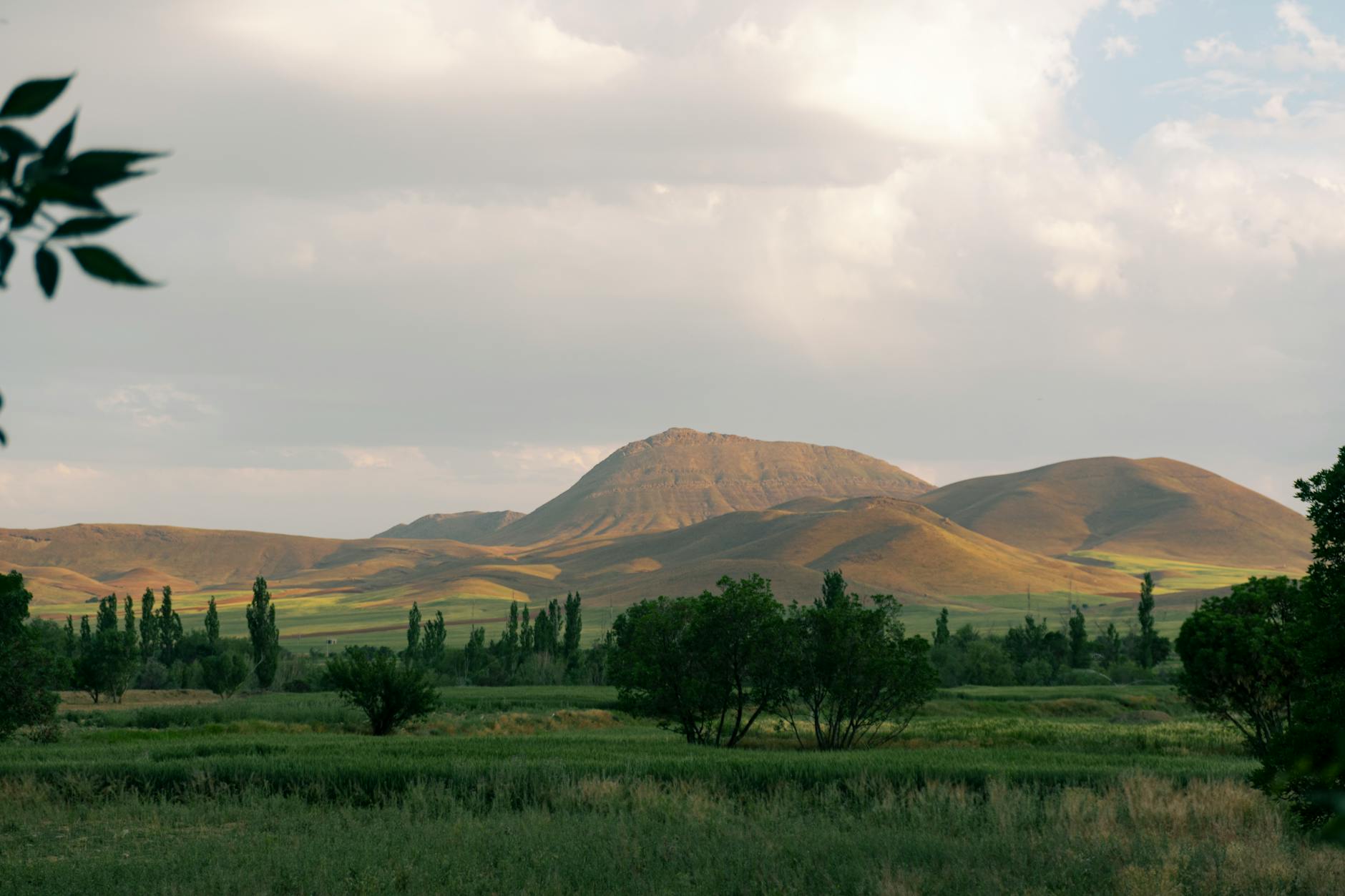
Iran is, by almost every meaningful military and geographic measure, one of the hardest countries on Earth to invade and occupy. Its territory spans approximately 1.65 million square kilometers — roughly four times the size of Iraq and larger than France, Germany, and the United Kingdom combined — and that territory is defined by massive mountain ranges, brutal deserts, and dense urban centers housing a population of roughly 93 million people. When politicians in Washington talk casually about military options against Iran, they are either unaware of or deliberately ignoring the physical reality of the country they are discussing. Military analysts at 19FortyFive assessed in March 2026 that invading Iran would be “one of the most complex military operations in modern history,” and that even if conventional Iranian forces were defeated on the battlefield, irregular warfare could continue for years across mountainous and urban terrain. This is not hypothetical hand-wringing.
The geography itself dictates these conclusions. The Zagros Mountains form a 1,600-kilometer wall along the country’s western border. The Alborz range seals off the north. Two enormous deserts divide the interior. And Tehran alone holds nearly 10 million people in a metropolitan area comparable in density to New York City. This article breaks down exactly why Iran’s physical landscape makes control — whether through invasion, occupation, or sustained military pressure — an extraordinarily dangerous proposition.
Table of Contents
- Why Do Iran’s Mountains, Deserts, and Cities Make It So Difficult to Control?
- The Zagros and Alborz — Iran’s Mountain Walls and Their Military Implications
- The Deserts That Divide Iran From Within
- Tehran and Iran’s Urban Density — A Different Kind of Battlefield
- Ethnic Diversity and the Problem of Peripheral Resistance
- Iran’s Size Compared to Past U.S. Military Operations
- What Iran’s Geography Means for U.S. Policy Going Forward
- Conclusion
- Frequently Asked Questions
Why Do Iran’s Mountains, Deserts, and Cities Make It So Difficult to Control?
The short answer is that iran functions as a natural fortress. The Zagros Mountains stretch from the Turkish and Iraqi borders in the northwest to the Strait of Hormuz in the southeast, with peaks exceeding 4,000 meters. These are not rolling hills. They are a massive physical barrier that prevents large-scale armored movements into the country from the west — the most likely invasion corridor given the geography of Iraq next door. Any military force attempting to push through the Zagros would face the same kind of channelized, defensible terrain that has stalled armies for centuries. Along the northern edge, the Alborz Mountains rim the southern coast of the Caspian Sea.
Mount Damavand, at 5,610 meters, is the highest peak in Iran and the second-highest mountain on the Eurasian landmass west of the Hindu Kush. Together, the Zagros and Alborz essentially enclose the iranian plateau, creating a geographic situation where any invading force must fight uphill and through passes before reaching the country’s interior. Compare this to Iraq in 2003, where coalition forces crossed mostly flat desert terrain to reach Baghdad in three weeks. Iran offers no such luxury. And even once inside, an occupying force would confront the deserts and the cities. The Dasht-e Kavir and Dasht-e Lut are not just empty space on a map — they function as internal barriers that divide Iran into separate territorial compartments, making unified control across the country a logistical nightmare. Meanwhile, Iran’s urban population of approximately 68.5 million people is concentrated in cities that would each present their own distinct occupation challenge.
The Zagros and Alborz — Iran’s Mountain Walls and Their Military Implications
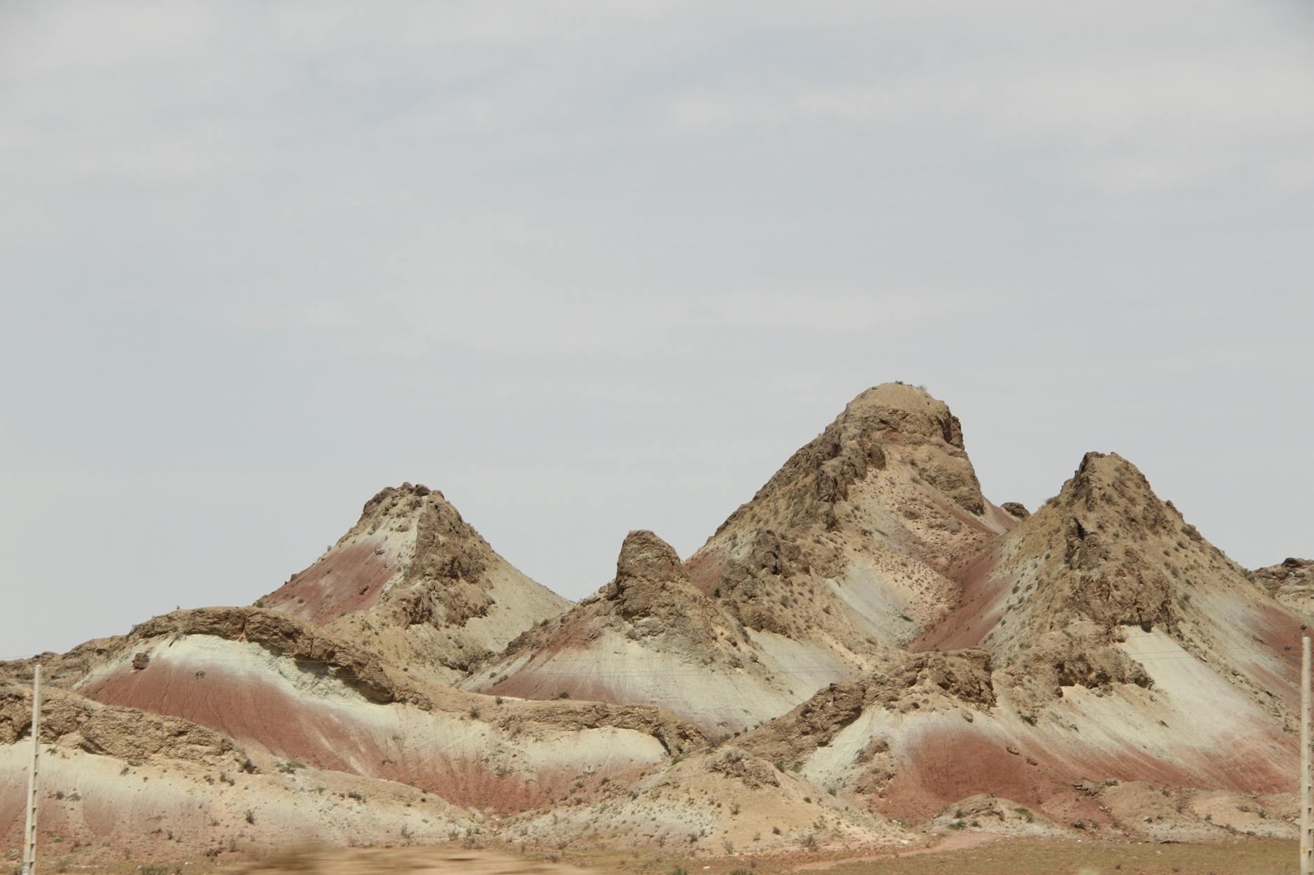
The Zagros Mountains are the dominant geographic feature of western Iran. Running roughly 1,600 kilometers from the northwest to the southeast, they form the spine of the country’s natural defense. The range is not a single ridge but a series of parallel folds and valleys, which means that even if an invading force breaches one line of mountains, additional ridgelines await behind it. Peaks routinely exceed 4,000 meters. For context, that is higher than any point in the contiguous United States. Heavy armor, supply convoys, and mechanized infantry — the backbone of a conventional invasion force — struggle badly in this kind of terrain. The Alborz range presents a different but equally serious obstacle.
Stretching along Iran’s Caspian coast, it separates the humid, densely populated lowlands of the north from the arid interior plateau. Mount Damavand towers over the range at 5,610 meters. The Alborz is narrower than the Zagros but steeper, and it guards some of Iran’s most important population centers. Any approach to Tehran from the north must reckon with this barrier. However, mountains cut both ways. If Iran’s mountain ranges make invasion difficult, they also create challenges for the Iranian government itself. Ethnic minorities — Kurds in the northwest Zagros, Baluchis in the southeast — have historically used mountainous terrain to resist central authority. Any post-invasion scenario would likely see these same geographic features exploited by insurgent groups of varying loyalties, making the country even harder to stabilize than it would be to conquer.
The Deserts That Divide Iran From Within
The eastern half of Iran is dominated by two enormous deserts: the Dasht-e Kavir (Great Salt Desert) and the Dasht-e Lut. These are not marginal features at the edge of the country. They sit on the central plateau at an average elevation of roughly 900 meters and act as internal barriers that effectively divide Iran into separate geographic compartments. Moving troops or supplies across them is not a simple matter of driving through sand — the Dasht-e Kavir is characterized by salt marshes and crusted surfaces that can swallow vehicles, while the Dasht-e Lut has recorded some of the hottest surface temperatures ever measured on Earth, reaching approximately 70.7°C (159°F). For a military planner, these deserts mean that controlling western Iran does not mean you control eastern Iran, and vice versa.
Supply lines stretching across the desert interior would be vulnerable, extended, and difficult to protect. The population density in these desert regions is extremely low compared to the mountainous west and north, which means there is little local infrastructure to commandeer and few roads capable of supporting heavy military traffic. The practical effect is that Iran cannot be conquered piecemeal. You cannot simply take Tehran and declare victory, because the geographic compartmentalization of the country means that resistance can persist in areas that are physically disconnected from the capital. This is a problem the United States encountered in Afghanistan on a smaller scale — and Iran is far larger, far more populated, and far better armed.

Tehran and Iran’s Urban Density — A Different Kind of Battlefield
Iran’s urban landscape presents challenges that are entirely distinct from its mountains and deserts. The country is approximately 73.5% urbanized, with an estimated 68.5 million people living in cities as of 2026. Tehran alone has a metropolitan population of roughly 9.84 million, with a density of about 11,800 residents per square kilometer — comparable to New York City. Mashhad exceeds 2 million residents, on a scale comparable to Los Angeles. Isfahan matches Houston. Karaj holds 2.1 million. Shiraz, Tabriz, Qom, and Ahvaz each exceed one million. The comparison to Iraq is instructive and sobering.
Iraq’s population at the time of the 2003 invasion was roughly 25 million. Iran’s current population is approximately 93 million — nearly four times larger. The Battle of Fallujah in 2004, fought in a city of roughly 300,000 people, required thousands of U.S. troops, lasted weeks, caused massive destruction, and became one of the bloodiest engagements of the entire Iraq War. Now multiply that problem by dozens of Iranian cities, each larger than Fallujah, each with more complex infrastructure, and each populated by citizens with a literacy rate of approximately 90% — meaning a highly organized, politically aware population capable of sustained, coordinated resistance. Defense analysts have estimated that occupying Iran would require hundreds of thousands of troops, and even that figure may be optimistic. The U.S. deployed roughly 130,000 troops for the initial invasion of Iraq, a country one-quarter the size and one-quarter the population of Iran. Scaling up proportionally would suggest a force of over half a million — before accounting for the dramatically more difficult terrain.
Ethnic Diversity and the Problem of Peripheral Resistance
Iran is not an ethnically homogeneous country, and this adds another layer of complexity to any attempt at control. Persians make up the majority, but significant populations of Azeris, Kurds, Arabs, Baluchis, and other minorities populate often peripheral regions of the country. The Azeris are concentrated in the northwest, near the Turkish and Azerbaijani borders. The Kurds occupy the western Zagros. Arab populations are concentrated in the oil-rich Khuzestan province in the southwest. Baluchis inhabit the remote southeast, bordering Pakistan and Afghanistan.
This ethnic geography matters because it means that different regions of Iran have different grievances, different loyalties, and different potential responses to any invasion or occupation. An occupying force would not face a single unified resistance but rather a patchwork of armed groups with competing agendas — some fighting the occupiers, some fighting each other, and some attempting to carve out autonomous zones. This was precisely the dynamic that made Iraq so ungovernable after 2003, and Iran presents a far more complex version of the same problem. The warning here is straightforward: anyone who suggests that an invasion of Iran would be greeted by a grateful population eager for regime change is ignoring both history and demographics. Iran’s ethnic diversity does not translate into a simple pro-Western coalition waiting to be liberated. It translates into a fragmented, unpredictable landscape of armed actors operating in terrain that favors the defender.

Iran’s Size Compared to Past U.S. Military Operations
To put Iran’s scale in concrete terms: its 1.65 million square kilometers make it larger than the combined territory of France, Germany, and the United Kingdom. The United States struggled to pacify Iraq, which is roughly 438,000 square kilometers. Afghanistan, at about 652,000 square kilometers, consumed twenty years of American military effort and trillions of dollars before the U.S.
📨 Get Free Accountability Coverage Alerts
Free · No spam · Unsubscribe anytime
withdrew without having achieved its stated objectives. Iran is larger than both of those countries combined, with a population exceeding both of them combined, defended by geography that is more formidable than either. The national population density of 57 people per square kilometer is deceptive because the population is highly concentrated in the north, northwest, and west — precisely the regions protected by the mountain ranges. Any military planner looking at a map of Iran should see a country that was, in a sense, designed by geology to resist external control.
What Iran’s Geography Means for U.S. Policy Going Forward
The geographic reality of Iran does not change based on who occupies the White House or what rhetoric dominates cable news. Mountains do not move. Deserts do not shrink. Cities of ten million people do not become easier to occupy because a president says they will.
The UN projects that Iran will reach 80% urbanization by 2030, meaning the urban control problem will only grow more acute in the coming years. This does not mean that Iran is immune to pressure or that diplomacy is pointless — quite the opposite. It means that military options against Iran carry costs and risks that are categorically different from previous American interventions in the Middle East. Policymakers and voters who hear talk of military action against Iran deserve to understand what the geography actually looks like, because the geography is the single best predictor of how such a conflict would unfold.
Conclusion
Iran’s physical landscape — the 1,600-kilometer Zagros wall, the Alborz range with peaks above 5,600 meters, the vast interior deserts, and the dense urban centers holding nearly 70 million people — makes it one of the most difficult countries in the world to invade and occupy. Military analysts have called a potential invasion one of the most complex operations in modern history, and that assessment is grounded in measurable, verifiable geographic facts, not speculation. Any serious discussion of U.S.
policy toward Iran must begin with an honest accounting of these realities. The country is four times the size of Iraq, four times the population of Iraq at the time of the 2003 invasion, and defended by terrain that makes Iraq look like a parking lot by comparison. The mountains, deserts, and cities of Iran are not obstacles that can be wished away or bombed into irrelevance. They are permanent features of the landscape, and they will shape the outcome of any military engagement whether planners account for them or not.
Frequently Asked Questions
How big is Iran compared to Iraq?
Iran is approximately 1.65 million square kilometers, roughly four times the size of Iraq’s 438,000 square kilometers. Iran’s population of about 93 million is also nearly four times what Iraq’s was during the 2003 invasion.
What are the major mountain ranges in Iran?
The two dominant ranges are the Zagros Mountains, stretching about 1,600 kilometers along the western and southwestern borders, and the Alborz Mountains along the northern Caspian coast. Mount Damavand in the Alborz reaches 5,610 meters, making it Iran’s highest peak.
How many people live in Tehran?
Tehran’s metropolitan population is approximately 9.84 million as of 2026, with a population density of roughly 11,800 residents per square kilometer — comparable to New York City.
Why do military analysts say Iran would be hard to invade?
The combination of massive mountain barriers blocking conventional invasion routes, interior deserts that divide the country into compartments, a population of 93 million (73.5% urbanized), ethnic diversity across peripheral regions, and the sheer size of the territory — larger than France, Germany, and the UK combined — makes Iran exceptionally difficult to conquer and nearly impossible to occupy long-term.
How hot do Iran’s deserts get?
The Dasht-e Lut has recorded surface temperatures of approximately 70.7°C (159°F), among the highest ever measured on Earth. These extreme conditions make large-scale military operations in the desert interior extraordinarily difficult.
How many troops would be needed to occupy Iran?
Defense analysts have estimated that hundreds of thousands of troops would be required. For comparison, the U.S. deployed roughly 130,000 for the initial Iraq invasion — a country one-quarter Iran’s size and population. Proportional scaling would suggest a force exceeding 500,000, and many analysts believe even that would be insufficient given the terrain.
You Might Also Like
- Young Voters Under 30 Overwhelmingly Oppose the Iran War in Early Polling
- Trump Claims the U.S. Did Not Target Iranian Leadership — Israel Takes Credit for Khamenei
- This Division of Labor Lets Both Countries Claim Different Objectives